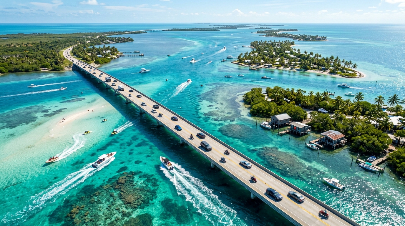
Leonida Keys Hero Landscape Artwork
Observed Status Mariana County // Florida Keys / Key West / Overseas Highway (US-1)
24.6°N 81.8°W
RADAR

Leonida Keys

Sun-Bleached Archipelago & Coral Barrier Reefs

A breathtaking chain of limestone and coral barrier islands strung across turquoise waters, connected to the mainland by precarious overseas viaducts. Home to deep-sea salvagers, rum-runners, eccentric beachcombers, and luxury marina enclaves.

Estimated Area
~32 km²
18% of Leonida
Elevation Profile
0m – 8m (Low-Lying Coral Cays)
Terrain Profile
Administrative Seat
Key Settlement Marina
Jurisdiction
Map Coordinates
24.5551, -81.7800
GPS Datum WGS84
Interactive Map · Live Coords

Explore Leonida Keys on the Interactive Map

Jump directly to Leonida Keys on our interactive map. Zoom, pan, switch between satellite and street views, and explore confirmed locations.

Territorial Landscape & Weather Profile

⛰ Topography

Flat, porous limestone cays barely rising above high tide. Fringed by pristine mangrove roots, white sandbars, shallow flats, and sudden deep oceanic drop-offs along the outer reef.

🌊 Hydrology

Divided between the calm, shallow waters of Florida Bay to the north and the deep Atlantic Florida Straits to the south. Intersected by swift tidal passes between islands.

⛈ Climate & Weather

Maritime tropical. Persistent ocean trade breezes, turquoise clear skies, violent sudden squalls, and severe vulnerability to storm tidal surges.

// Real-World Florida Inspiration

How Rockstar Adapted Florida Keys / Key West / Overseas Highway (US-1)

Streamlined into a dynamic archipelago of accessible cays connected by breathtaking cinematic bridge stretches.

Signature Landmark Inspirations: Seven Mile Bridge, Mallory Square sunset celebration area, Mile 0 buoy, and coral reef sanctuary lighthouses.

Factions & Jurisdiction

Underworld & Syndicates

Freelance maritime smugglers, salvage divers with dubious morals, and offshore tax-haven shell networks.

Law Enforcement Presence

Mariana County Sheriff & US Coast Guard Cutter patrols enforcing maritime borders and intercepting contraband craft.

Regional Atmosphere

Laid-back tropical bohemian exterior harboring clandestine offshore transactions and cutthroat maritime salvage.

Leonida Territorial Division · Mariana County

Documented Sub-Locations & Landmarks

5 Documented Zones
Highway Infrastructure Official

Seven Mile Overseas Viaduct

// Real: Seven Mile Bridge (US-1)

Iconic multi-mile concrete highway bridge vaulting across open ocean, with parallel derelict historical rail arches.

24.6950, -81.2500 Pin on Map →
Maritime Township Observed

Key Settlement Marina & Historic Quarter

// Real: Key West Old Town & Mallory Square

Conch-style Victorian wooden houses, lively dive bars, charter docks, and the southernmost geographic monument.

24.5551, -81.7800 Pin on Map →
Underwater Salvage Site Estimated

Sunken Spanish Galleon Reef

// Real: Nuestra Señora de Atocha Wreck Shelf

17th-century wooden shipwreck scattered across living coral heads, hiding gold coins, silver ingots, and antique cannons.

24.4800, -81.8200 Pin on Map →
Boating Sanctuary Observed

Pelican Shoals Sandbar

// Real: Islamorada Sandbar

Shallow sandbar where hundreds of party boats, pontoons, and jet skiers gather for open-water celebrations.

24.8900, -80.6200 Pin on Map →
Restricted Installation Estimated

Radar Rock Military Listening Post

// Real: Naval Air Station Key West / Cudjoe Key Blimp

Guarded radar dome surveillance station monitoring international maritime traffic and contraband airspace.

24.7100, -81.5000 Pin on Map →

Location-Tied Activities in Leonida Keys

Exploration & Maritime 📍 Keys Barrier Reef Drop-Off

Deep-Sea Scuba Salvaging & Treasure Hunting

Equip scuba gear or submersibles to explore sunken freighters, coral caves, and drug-running plane wrecks on the ocean shelf.

Motorsport 📍 US-1 Ocean Viaducts

Overseas Highway Cannonball Runs

High-speed point-to-point endurance sprints running wide open across ocean bridges with zero lane barriers.

Hunting & Fishing 📍 Gulf Stream Deep Channel

Big-Game Marlin Sportfishing

Charter offshore sportfishing boats into the Gulf Stream to battle blue marlin, sailfish, and yellowfin tuna.

Extreme Stunt 📍 Historic Disused Rail Bridge

Viaduct BASE Jumping

Leap from abandoned railroad trestles into the open ocean channel, timing parachute deployment between maritime vessel traffic.

Signature Regional Vehicles & Equipment

Personal Watercraft · Jet Ski

Nagasaki WaveRunner 1400

Agile 3-seater watercraft built for skimming shallow sandbars and navigating dense mangrove channels.

Yacht / Marine · Cabin Cruiser

Pegassi Deep-Sea Sportfisher 45ft

Tower-equipped sportfishing yacht with outriggers, livewells, and long-range diesel cruising capability.

Aviation · Amphibious Aircraft

Mammoth Dodo Seaplane

Twin-pontoon floatplane capable of touching down on calm lagoon waters directly outside remote island properties.

Classic Muscle · Convertible Cruiser

Albany Buccaneer Custom

Low-slung classic drop-top cruising the Overseas Highway under swaying palm trees.

Indigenous Wildlife of Leonida Keys

Apex Marine Predator Apex Predator

Great Hammerhead Shark

Habitat: Deep tidal passes and reef drops

Aggressive predatory sharks patrolling deep oceanic drop-offs, posing deadly danger to unprotected divers.

Endangered Indigenous Fauna Harmless

Key Deer

Habitat: Inhabited pine rocklands and island brush

Miniature deer subspecies endemic exclusively to the lower islands, fearless of human presence.

Sportfish Moderate

Atlantic Tarpon ("Silver King")

Habitat: Marina basins and bridge pilings

Massive acrobatic sportfish exceeding 150 lbs, leaping violently when hooked.